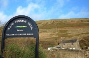
FAQ - South Yorkshire Way - South Yorkshire Way
Main menu:
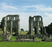
In producing this website, we’re trying to make it easy for you to find out all the information you need to have a great time walking along the two routes which make up the South Yorkshire Way. However, inevitably there remain some questions that we couldn’t work out the best place to put them so here they are.
If you can’t find the answer, post your question on Facebook or email us.
Q. When will the Way open?
A. It is open now! The launch of the trail was in April 2014 - 40 years after the creation of the county of South Yorkshire.
Q. How will I know I’m on the Way?
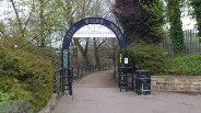
A. At present, until we are able to place way markers along the South Yorkshire Way, you won't be able to work it out on the ground. This website will contain details of the route, and websites such as Social Hiking will have GPS versions too. We're working on e-book guide for Kindle and iPad which will contain a more detailed route guide.
Q. Can I ride my horse or bike on the South Yorkshire Way?
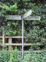
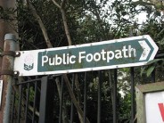
A. Generally speaking no - most of the South Yorkshire Way is along Public Footpaths rather Public Bridleways so it only available to people on foot. We will be looking into specific sections which will be able to be used by horses and/or bikes and they will be placed on the website shortly. We have tried to route along Bridleways where we can. For a great guide to the difference, visit the Walks Around Britain website here.
Q. Can I get my baggage moved between overnight stops?
A. We'll be working on trying to get companies interested in providing this type of service, which is very popular on other trails.
Q. How do you know how long the Way is?
A. We're measuring it using GPS (Global Positioning System) equipment allows us to accurately plot the line of the Paths and measure its exact length.
Q. Who owns the Way?
A. Most of the land that the South Yorkshire Way crosses is privately owned by many different individuals and estates. The Way itself is always on land where you have a legal right to walk across as you keep on the recognised Public Footpath or Public Bridleway.
Q. Who looks after the Way?
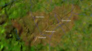
A. As the South Yorkshire Way is across Public Rights of Way, on-going maintenance and improvements of the paths are delivered on the ground by the four local councils - Barnsley, Doncaster, Rotherham and Sheffield - and the Peak District National Park - who each look after their own sections. Contact details for these will be found on their individual websites which will be reached from our Useful Links page. The South Yorkshire Way team coordinates the management and promotion of the whole route on a strategic basis and maintains this website.
Q. How much does the Way cost and who pays for it?
A. As the South Yorkshire Way is across Public Rights of Way, it requires no additional funding from local councils.
Q. How many people will use the Way and how much income does it generate?
A. That we don't yet know. It really will depend on the quality of the walking experience we can create by using the landscapes and the history of South Yorkshire together. Research shows that walkers along the South West Coast Path spend at least an estimated £222 million annually in the local economy, and whilst we don't expect that, we do think it will make a difference to the areas the trail passes through.
Q. Which way is it best to walk and where should you start?
A. It depends on which route you decide to do. We recommended the start for people doing the Boundary Route in 7 days to be Bawtry, just south of Doncaster. This is because Doncaster is central for most rail connections and the bus to Bawtry leaves the Doncaster Interchange, which is next door to the railway station. We are working on recommending a anti-clockwise route from Bawtry. However, it does really matter where you start and in which direction you take.
For the Central Route, you can take your pick from either end. As Thorne North and Dore & Totley Railway Stations are on the Central Route of the South Yorkshire Way, just start from whichever is easiest to get to.